RIS index table
RIS
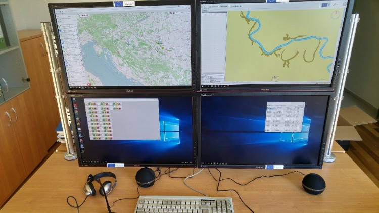
1. RIS in general:
RIS (River Information Services) - River Information Services are a group of related information, communication and navigation services to support traffic management and inland freight transport, including links to other types of transport.
The task of RIS is to improve the safety and efficiency of inland waterways transport, which contributes to their more intensive use, and to the reduced number and consequences of navigation accidents.
2. Basic RIS System Determinants:
- covers all inland waterways (rivers, canals, lakes);
- includes interface to other types of transport (maritime, rail, road);
- it integrates all individual information services that support internal navigation;
- collects, processes and transports information on the waterway, traffic and transportation.
3. RIS System Users:
3.1. at administration level:
- Administration responsible for inland navigation security (Ministry of the Sea, Transport and Infrastructure - Port Authority);
- Administration responsible for internal affairs - Immigration and Customs (Ministry of the Interior - Police and Ministry of Finance - Customs);
- administrations responsible for traffic management;
- emergency units in the event of navigation accidents;
- Waterways Management Authority (Waterways Agency);
- port administrations, etc.
3.2 at a commercial level:
- port operators and terminal operators;
- container terminal operators;
- shipping companies;
- freight forwarders;
- Providers of logistic services;
- shippers etc.
4. RIS mode of operation:
The RIS system is based on the application of modern information and communication services, and the basic concept of the system is information about the vessel and information on the waterway.
The vessel information is collected and transmitted via an automatic identification receiver located on the boat, the so-called. AIS (Automatic Identification System) Receiver, and by base stations on land that receive information and send them directly to the RIS system.
Information on the waterway is contained in the form of electronic navigation charts (ENC) and NtS (Notice to Skippers).
All information, nautical data and current traffic status are available in real time and are automatically stored in the central database, from where they can be downloaded at any time and ready to use.
5. RIS information:
River information services are based on two IT levels.
5.1. Strategic traffic information:
- influence the medium and long term decisions of RIS system users;
- contributes to the implementation of planning decisions and a safer and more economical implementation of travel;
- are created in the RIS center and at the request of the system user are delivered;
- depict the picture of all vessels in the RIS area, giving insight into their characteristics, cargo loads and the position they are in;
- stored in databases and, if necessary, displayed on the electronic navigational chart and tables.
5.2. Tactical Traffic Information:
- related to current navigation decisions in the narrow geographical area;
- contain all relevant information on the position of the ship, shown on the electronic navigational chart;
- are available on the boat, and at the RIS center on the coast;
- assist vessel commanders in the immediate adoption of navigational decisions and consultations with commanders of other vessels on the waterway.
6. RIS services:
All services that the system offers to end users.
6.1. Information on the waterway:
- contain geographic, hydrological and administrative data on the waterway in the area covered by the RIS system;
- enable users to successfully plan, conduct and track trips;
- provide an overview of the current traffic situation and making timely and timely navigation decisions;
- aggregate all static and dynamic waterway information transmitted on the basis of a predetermined time plan;
- actuals are transmitted in real time, and security information is issued and confirmed by the competent authorities.
6.2. Traffic Management:
- it enables monitoring, control of the situation and action in accordance with available information, which is particularly important in areas of heavy traffic, in approaches to the constitutions, ports, bridges and other control points set by the navigation control bodies;
- greatly contributes to increased utilization of infrastructure and increased navigation safety.
6.3. Accident prevention:
- at the start of the voyage, each vessel submits the data to the RIS Center and updates them during the journey;
- in the case of a navigational accident, the RIS Center shall without delay provide the data to rescue and emergency services.
6.4. Information for transport logistics:
- include planning of boat arrivals in ports and departures from ports, monitoring of port and technological processes;
- enables information exchange between fleet operators, vessels, terminals, customs and other interest groups.
6.5. Information for monitoring implementation:
- facilitate the management of cross-border procedures, alignment with traffic and other relevant regulations for inland navigation.
6.6. Statistical and statistical data services:
- contributes to a better and simpler collection of statistical data related to inland navigation;
- data are collected by companies and responsible administrative levels of inland navigation and are used for the purpose of monitoring and strategic planning.
6.7. Insights and Cost Planning:
- easier and faster collection of fees without administrative burdens;
- ship travel data can be used for automatic billing and invoicing.
7. Advantages of a RIS system
- monitoring of the waterway and the vessel;
- increasing traffic safety;
- preventing navigation accidents;
- monitoring and rapid response in case of navigation accidents;
- supervision of the transport of dangerous goods;
- better resource management in ports and terminals;
- nautical support for boat commanders;
- better and simpler planning of transport processes;
- facilitating the integration of inland navigation into intermodal and logistics lanes;
- optimization of logistics processes;
- accelerating navigation and reducing fuel consumption.
8. RIS Service Organization:
The RIS Service is organized within the Waterways Agency, as the National RIS Headquarter managed by the National RIS Coordinator.
8.1. National RIS Center (NCC):
- is responsible for the RIS system compliance, operations and procedures by the RIS Centers, the RIS user access, and the international data exchange system generated by the system, to ensure interoperability;
- provide relevant data related to navigation and travel planning to users of River Information Services in accessible electronic form;
- provides the availability of Electronic Navigation Charts to all RIS users;
- publishing of Shipping Notices (NtS), such as water level or maximum allowed draft of ship and ice reports in standardized, coded and ready to read formats;
- secured data exchange via electronic vessel reports (ERI), which implies the definition of access rights to be granted to specific users for access to particular data and information;
- monitors the functionality of the system and individual services;
- database administrator for AIS, ERI, NtS, boat hull data, communication portal, etc.

8.2. RIS centers:
- RIS Center Vukovar at the Harbormaster’s office of Vukovar;
- RIS Center Osijek, at the Harbormaster’s office of Osijek;
- RIS Center Slavonski Brod, at Harbormaster’s office of Slavonski Brod;
- RIS Center Sisak, at the Harbormaster’s office of Sisak.